CCU gets a new research vessel
by Bracey
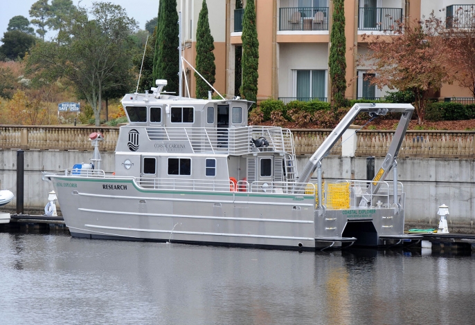
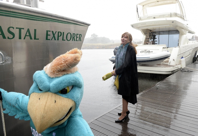
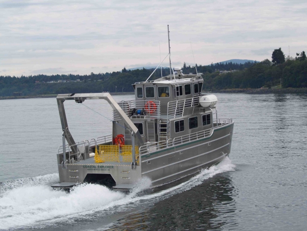
Coastal Carolina University’s new research vessel, The Coastal Explorer, was christened on Nov. 15 at the Grande Dunes Marina, marking a major leap in CCU’s marine science graduate program. The new vessel will allow CCU to play a larger role in the economic development and environmental protection of the coastal community.
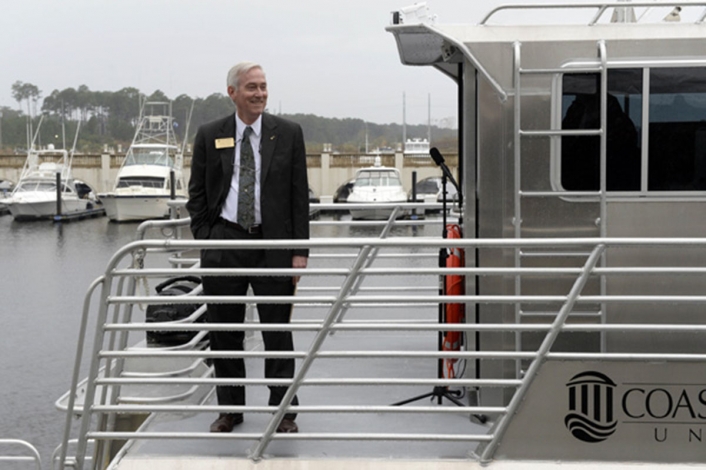
“The Coastal Explorer is a game-changer for us,” says Paul Gayes, director for the School of Coastal and Marine Systems Science. “It’s large enough to take at least 20 students out at a time, which is a huge improvement on the one or two students we were taking before.”
Over the last several years, CCU’s marine science program has brought in millions of dollars of equipment through grants, but instructors were limited on the number of students they could train to use it.
“Now, we have the best gear there is, and we can embed this systemic training into our new graduate and Ph.D. program,” says Gayes. “We can rally around these capabilities, resources and expertise because this is something that students from all over will want to come here for.”
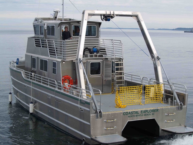
The aluminum 54-foot Coastal Explorer shines on the water. It is set up with three data acquisition workstations in the main cabin and two additional workstations on the bridge. The water systems have a saltwater line piping water from the ocean to the cabin in order to analyze the water quality.
There is a winching system that towers over the rear of the boat, able to accommodate an 8,000-pound lift capacity for deploying heavy research equipment, including the sensor buoys used in CCU’s new hurricane model, an effort to forecast severe weather conditions.
“That sensor buoy is offshore, feeding data to us to help validate and improve the model,” says Gayes. “This vessel not only allows us to deploy the buoy, but we’re continuing to write proposals for more advanced buoys to develop much better resolution of the atmospheric ocean models in the future.”
On the front of the boat, a sonar is mounted that can rotate down below the catamaran hull and lock in place. This sonar aligns with GPS receivers and motion sensors in order to get a geophysical map of the sea floor.
“It’s all very, very accurate, letting us know where everything is on the bottom,” says Gayes. “The mapping will help with future developments, like the potential wind farms or other industries like oil and gas. There are fundamental questions that need to be asked in terms of environmental impacts and benefits. We’ve already mapped five miles out from the beach, from Little River down to Georgetown, with the U.S. Geologic Survey. Now, we can run these types of analyses even farther offshore to avoid cabling through essential fish habitats or to make sure the substrates are appropriate to support the structures.”
The mapping could also aid in local dredging projects to accommodate for larger ships in the post-Panama Canal expansion. “We just finished a project for the Corps of Engineers in the spring that targeted where essential fish habitats are off the Charleston harbor,” says Gayes. “We also helped map out areas where that dredge material would go.”
In addition, the ship will assist in answering some of the questions associated with hypoxia (an aquatic condition caused by dissolved oxygen and the lower oxygen levels result in fisheries and sea life dying), as well as lend support to student projects such as building artificial reefs.
And Gayes has plans to bring in another piece of large equipment. “I’m working on a project that will use an ocean coring system so we can drill and drive cores down in various areas of the sea floor,” Gayes says. “These cores would not only give us information about climate change and environmental changes over time, they also have very practical applications, like relocating large quantities of quality sand for beach erosion projects.”
The vessel will be manned by an operations crew stationed in CCU’s Burroughs & Chapin Center for Marine and Wetland Studies. The crew has worked on vessels for the USS Coast Guard, the National Oceanic and Atmospheric Administration (NOAA) and contract vessels for national geological surveys and the Scripps Institution of Oceanography.
Sharing dock time between Harbourgate Marina in Little River and Harborwalk Marina in Georgetown will permit the crew to focus on different issues and projects along the Grand Strand while being mindful of fuel and time.
Previous to the Coastal Explorer, CCU had three other crafts in its fleet – a 24-foot fiberglass boat known as “The Privateer,” a 19-foot Carolina Skiff known as the BERM Boat and an 11-foot inflatable boat known as “The Leading Lady.”
“Our mission at CCU is to understand this complex coastal system – how the land, atmosphere and ocean work together,” says Gayes. “So much of our society’s economy is embedded in this system. We need to see how it all works together to get better at our predictive capabilities and the projections we give to society to inform the decisions on how to best steward and sustain the resources that are such a big part of our economy.”
When Gayes joined the CCU falculty, he was only the fourth faculty member in the marine science program. “There were hardly 80 students in the program, and now there are more than 900,” he says. “We’ve come a long way since then, and this vessel is a huge leap for us. It is a bridge in our research, to bring the modelers together with the observationalists, to train the next generation of scientists to deal with those important problems that go with the coastal zone – dredging, erosion, fishing, tourism, water quality – these are fundamentally important problems and not just for our society but worldwide. This is the continuation of CCU reaching out to make a difference in the world.”