HUGO team at CCU forecasts more active hurricane season for 2016
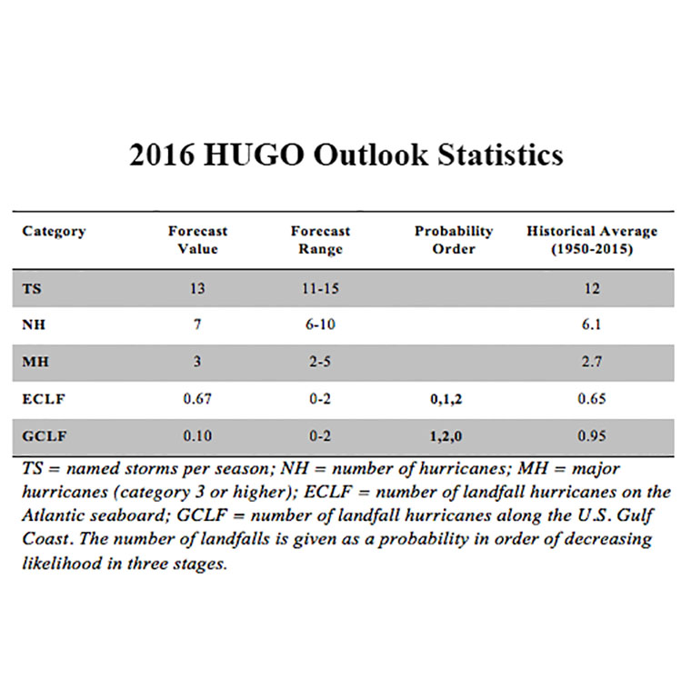
The HUGO outlook (detailed in the table below) predicts that there will be a range of 11 to 15 (with 13 most likely) named tropical storms, with from 6 to 10 (with 7 most likely) becoming hurricanes and 2 to 5 (with 3 most likely) becoming major hurricanes during the 2016 season (June 1 to Nov. 30).
"The scenario for landfalls is more complicated than in the last two years," says Len Pietrafresa, research professor in CCU's School of Coastal and Marine Systems Science (SCMSS) and leader of the HUGO team. "The most important climate factors which determine the most likely pathways of the hurricanes appear to be changing rather rapidly at this point in time." Updated outlooks will be released monthly during the hurricane season in June, July and August as more observational climate data become available.
The most probable scenario for landfalls, according to the April study, is that no hurricanes will make landfall on the U.S. East Coast and that one hurricane will make landfall on the U.S. Gulf Coast during the 2016 season. The second most likely scenario is that one hurricane will make landfall on the East Coast and that two hurricanes will make landfall on the Gulf Coast. The third most likely possibility is that two hurricanes will make landfall on the East Coast and no hurricanes will make landfall on the Gulf Coast.
Last year's HUGO outlook forecast of a "below normal" season was highly accurate. The 2015 outlook correctly forecast a most likely scenario that no hurricanes would make landfall on either the East or Gulf coasts. Last year's outlook also accurately forecast the number of hurricanes at four.
The HUGO team's outlook report for 2016 notes that the above scenario is highly dependent on the variations of climate factors in May, June and July, primarily the El Niño Southern Oscillation (ENSO) and the Atlantic Multi-decadal Oscillation (AMO). The key issues at this point in time are: (1) how quickly the current El Niño will weaken and turn into either a Neutral or a La Niña phase; and (2) how warm the upper ocean of the North Atlantic Ocean will become.
The HUGO Hurricane Landfall Outlook Program is a unique hurricane model system developed by scientists at Coastal Carolina University and unveiled in 2013. The model differs from most other hurricane prediction instruments in that it offers hurricane number landfall probability information. In addition to the seasonal outlook, the model system predicts the track and intensity as well as data on the surge, inundation and flooding potential of any incoming hurricane five days away from landfall.
The HUGO hurricane seasonal outlook model is based on calculations of 22 climatological factors encompassing oceanic, atmospheric and shoreline activity. The model also considers detailed statistical data from previous Atlantic hurricanes going back to 1950, a methodology that has produced highly accurate track predictions in hind-casting tests conducted by the team at CCU. The HUGO team has made a significant advance in computing a key factor in advance of an upcoming season, the Accumulated Cyclone Energy (ACE) Index, which calculates the kinetic energy of storms based on the summation of all tropical storm wind values, observed over an entire hurricane season.
Also, because the HUGO model system provides specific data on probable storm surge and inundation as a hurricane approaches, including time, location and statistical representations of expected water depth along the coastline, it has special relevance for emergency management officials in their logistical planning in the event of evacuations.
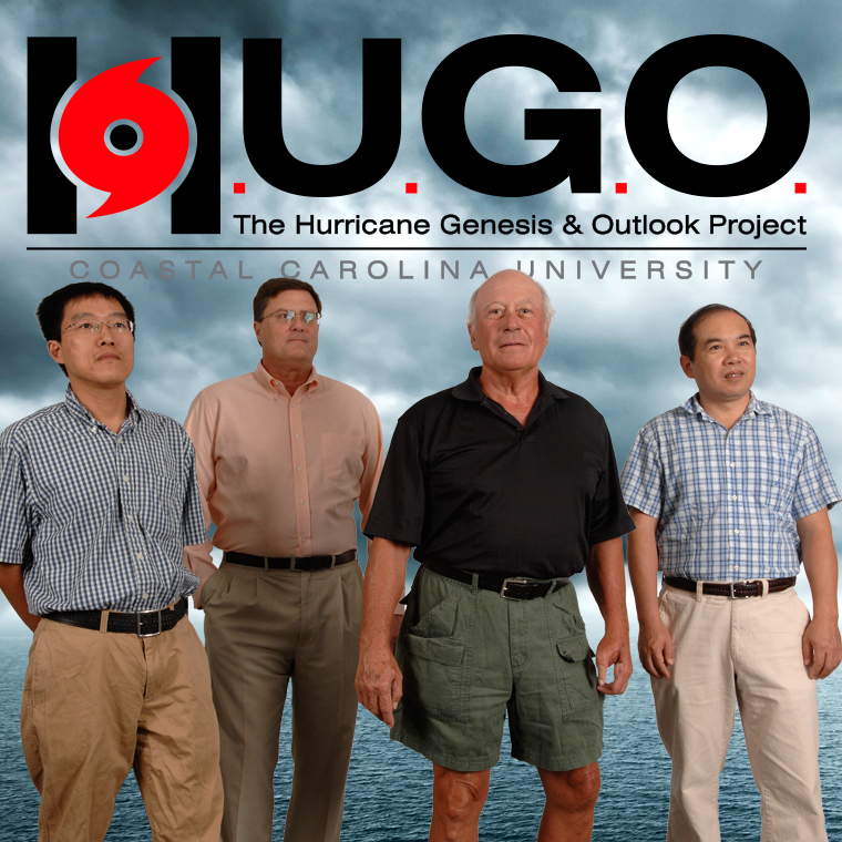
The end-to-end HUGO model system was developed by a group of climatological and weather scholars of international standing led by Pietrafesa, former chair of the National Oceanic & Atmospheric Administration (NOAA) Science Advisory Board and of the National Hurricane Center External Advisory Panel. Other members of the CCU team are Shaowu Bao, a computational, deterministic numerical modeler specializing in meteorology and oceanography and a professor in SCMSS at CCU; Tingzhuang Yan, a meteorological oceanographer with a background in statistical modeling of climate and weather systems and a Burroughs & Chapin Research Scholar in SCMSS at CCU; and Paul Gayes, longtime CCU professor and director of SCMSS.
The Hurricane Seasonal Outlook is a greatly advanced version of the model system developed in Yan's Ph.D. dissertation in 2006 at North Carolina State University and funded through a grant from the NOAA Coastal Services Center in Charleston, the National Research Council and the NOAA National Centers for Environmental Prediction. The individual hurricane track and intensification and landfall surge and flooding model system is based on the interactively coupled model system developed by Bao and Pietrafesa under prior NOAA funding through the NOAA Coastal Services Center in Charleston.
For more information about CCU's HUGO Project, contact Pietrafesa at 843-349-4017 or 704-910-7047 or email lpietraf@coastal.edu. The complete report is available at the HUGO website .